
Whether you’re a keen hiker or just want new ideas for leisurely strolls, why not limber up with these useful and inspirational apps?
More of us than ever are exploring the great outdoors on foot. Whether it’s wandering around our local neighbourhoods on weekend walks or planning an ambitious hiking holiday in one of the UK’s numerous national parks.
If you’re struggling for itinerary ideas, either because you’ve thoroughly walked your local patch during lockdown or you’re overwhelmed by the rich variety of the UK’s green spaces, then this guide will help.
Our selection of mobile apps will not only help you plan your walk or hike, but also help keep you on the beaten path once you’re under way.
Go Jauntly
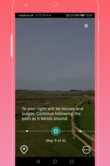
If you’re paranoid about getting lost while out walking, then Go Jauntly can help. This app not only suggests walking routes, but provides full-screen photographic directions for each and every step of your chosen walk. Some of its suggested routes can only be viewed if you have subscription, which costs £2 a month or £20 a year. The subscription unlocks other useful features, such as the ability to download maps so they can be viewed without an internet connection.
Komoot
Whether you want to walk around London or hike through the Lake District, Komoot is your friend. This app not only provides detailed maps for its suggested routes, but includes elevation profiles and route notes, with photos of landmarks along the way. Just as importantly, the route notes also include details about difficulty levels so you can make an informed decision on how far you want to challenge yourself.
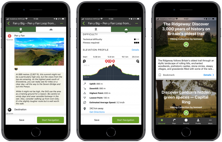
Some features, such as the ability to download maps, including dedicated maps for cycling and mountain biking, cost extra. Pricing varies depending on the features you want and whether you’d like coverage for specific countries or worldwide.
OS Maps
Regular walkers and hikers will be familiar with Ordnance Survey (OS) paper maps. The 1:25,000 scale OS Explorer series of maps are especially useful, not just because public footpaths and many National Trust trails are marked on them, but also for determining the steepness of slopes, hills and mountainsides.
Less well-known is the fact that every printed OS Explorer map comes with a download code allowing you to view and save a digital version of that map in the OS Maps app. Paired with your smartphone’s GPS, you can quickly pinpoint your location and get your bearings.
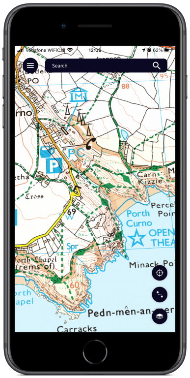
If you cough up a bit extra, you can subscribe for additional features such as an Augmented Reality (AR) view giving you onscreen information about landmarks visible through your smartphone’s camera.
OS Navigate
The OS Maps app is a convenient companion to a printed map and compass, but it’s not a complete replacement for that classic pairing. If you’re hiking in an especially remote part of the countryside with patchy GPS coverage, being able to use a traditional map and compass can be a lifesaver.
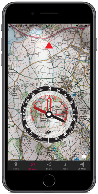
That’s where the separate OS Navigate app comes in. It turns your phone into a virtual compass which, using the view from your phone’s rear camera, can be laid on top of a paper map so you can get your bearings and plot a path. If you don’t know how to do that, an in-app manual can teach you how.
Imray Tide Planner
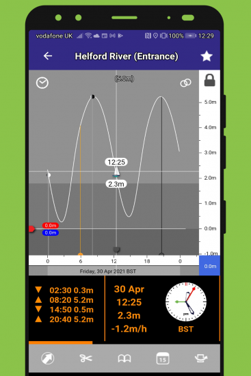
If you’re walking along one of the UK’s many splendid coastal paths, it may well be useful to know when it’s high tide and low tide. Imray Tide Planner is an app that not only lists the times for high and low tide at various locations around the UK, but also the water height, which could be especially useful if you need to ford a stream or inlet.
The old-fashioned user interface takes some getting used to, but it’s worth bearing with as Tide Planner is one of the very few tide times apps that lists both water height and tide times.
PackSizer by Osprey
Whether you need a small day bag for a ramble between pubs or a climbing pack for a long expedition, choosing a bag that’s both spacious enough and a proper fit can be tricky. Especially if you don’t yet feel comfortable enough to visit a physical store. In that case, the PackSizer app from bag manufacturer Osprey can help.
Get someone to take a photo of you using the app and it’ll suggest bags and packs that should be the right fit for your body size. An in-app guide can help you further narrow down the specific bag you need. Even if you decide Osprey packs aren’t your bag, at least you’ll have a good idea of the size you’ll need.
what3words
No one wants to think about worst-case scenarios, but accidents and other perilous mishaps can strike walkers and hikers when they’re least expected. If you don’t know where you are when disaster strikes, you can still let the emergency services know your precise location using what3words.
As long as you have a GPS signal and a mobile connection good enough to make a 999 call, you can use this app to distil your location into three, short, easily pronounced words. Most emergency operators in the UK can then use what3words and translate them back into GPS co-ordinates for your precise location, so they can then despatch assistance.
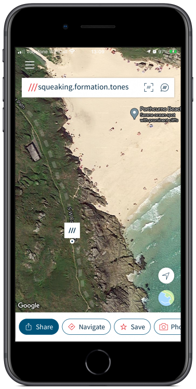
Alongside the well-worn method of letting someone know that you’re out walking and when you should be expected at your destination, installing this free app on your phone ahead of time could just save your bacon.
Follow @VodafoneUKNews on Twitter.


![mother with daughter with smartphone in snowy weather [Adobe Stock] stock photo of a mother outside in snowy weather with her daughter while using a smartphone](https://www.vodafone.co.uk/newscentre/app/uploads/2024/02/mother-with-daughter-with-smartphone-in-snowy-weather-Adobe-Stock.jpg)
